
How to Search Mineral County Property Records
Start with the statewide assessment search when an address or owner name is the only clue. Set the county field to Mineral. A street-name query can pull several parcels on the same road. An owner query may return more than one property, or a name shared by strangers. Once a result gives a district, map, parcel, and root parcel ID, keep those values together. Treat them as a set. That parcel key links the assessment card to the WV Property Viewer. It also links to the Mineral County Clerk's recorded deed index. Each record answers a different question. The Assessor sets the annual value. The Sheriff-Tax Office collects the bill. The County Clerk holds the recorded transfers and encumbrance documents. The statewide viewer adds map context. But its tax lines are no substitute for a legal survey. Some deed coverage predates the online index. Ask the Clerk which books and indexes to check for those. A Mineral County property search works best when carried from one custodian to the next.
- Search the WV Assessment Search by street name, owner name, or parcel parts, and select Mineral County.
- Copy the parcel ID, property address, owner, and any deed book and page fields from the result.
- Use the Clerk’s WV Land Records index for deeds, deeds of trust, liens, plats, and releases.
- Check the Sheriff-Tax search for the bill or delinquency status, then use the GIS viewer for map context.
- Call or visit the record custodian for an older book, a missing image, a correction, or a certified copy.
Mineral County Property Records Offices
Why does Mineral County split property records among offices? A recorded deed, an assessed value, and a tax payment serve different jobs. The County Clerk is the land-record custodian. The Assessor lists and values real and personal property each year for the tax roll. The Sheriff-Tax Office collects the tax bill and handles delinquent real-estate tax sale matters. A municipality may keep its own permits or zoning files, but city hall cannot replace the county Clerk or Assessor for land title and parcel assessment.
Mineral County Clerk
County Courthouse, 150 Armstrong Street
Keyser, WV 26726
304-788-3924
Mineral County Assessor
County Courthouse, 150 Armstrong Street
Keyser, WV 26726
304-788-3753
Mineral County Sheriff-Tax Office
County tax collection and delinquency
Official office contact page
See current county contact listing
Mineral County Assessment Search Starts With Three Keys
The state assessment form accepts several keys. These include a county, district, owner name, street name, full parcel ID, map number, parcel, and sub-parcel. Search by street name when the address format is uncertain. Use an owner search only when the name is known. Narrow the result with a town or parcel clue where you can. One row may not be the whole story. A spelling difference, a trust name, or a co-owner can split what looks like one property history across several rows. The WV Property Assessment Search returns fields such as Current Owner, Property Address, district, map, and parcel. It shows a flood indicator and deeded acres too. Property class, land-use code, and building, land, and total appraisal also appear. Its help notes that one owner or address may appear in a summary. The detailed card can hold more. The search is free. The result list is capped at 1,000 rows and can be exported as CSV.
Use the MapWV assessment search page to view its available fields. 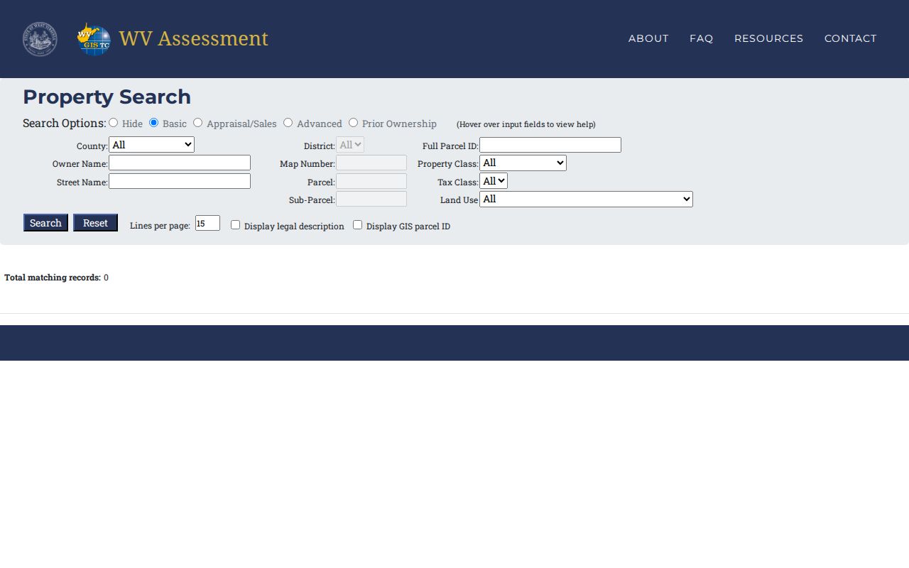 Its field groups let a searcher narrow by appraisal range, acreage, sale date and price, flood hazard, deed book and page, legal description, or building traits.
This field-rich form is the strongest first stop for a parcel clue. It is not the deed index, and it settles no title question.
Mineral County Values Follow an Annual Cycle
The Assessor discovers, lists, and values property each fiscal year beginning July 1. The assessment books close June 30 of the following year. County guidance puts assessed value at 60 percent of fair-market or appraised value. That ratio exists for taxation. A public appraisal figure is not a promise of a sale price. Nor is it a substitute for a private appraisal in a purchase. State assessment data refreshes annually when the new tax assessment is released. A simple sale may not flow through at once. Ownership and parcel geometry can lag the recorded deed. Transfers made from July through June have one state deadline. They are due by February 1 of the next calendar year. The state advises contacting the local Assessor if parcel lines remain unupdated after two years. A Mineral County owner who sees a mismatch should set the deed date beside the assessment date. The Assessor can then explain which record controls the current roll. The Mineral County Assessor's valuation page explains the annual fair-market method and the 60-percent relationship. That timing has an everyday effect. The newest deed can outrun the owner name on a summary card.
See the Mineral County Assessor guidance for supporting context.  shows the county’s valuation guidance. Use the assessment value as a tax record, then confirm a recent transfer in the land records.
Types of Mineral County Property Records
Mineral County property records cover transfers, tax status, and values. They also cover parcel geography and local work on a building. A record can be public and still have limits. Online coverage does not reach every historic year. The Assessor's summary is not the full chain of owners or a legal opinion. Start with the custodian that created the record. Then compare it against the source that proves the next step.
| Record Type | What It Documents | Kept By | Access |
|---|---|---|---|
| Deeds and plats | Transfers, legal descriptions, lot and block references | Mineral County Clerk | WV Land Records and courthouse |
| Deeds of trust, liens, releases | Recorded financing and encumbrances | County Clerk; court or tax sources may also apply | WV Land Records; older coverage must be confirmed |
| Assessment roll | Owner, situs address, class, land and building appraisal | Mineral County Assessor | Free state search; annual data |
| Tax bill and delinquency | Amounts due, payment timing, tax-sale status | Sheriff-Tax Office | County-linked Software Systems search |
| GIS and tax maps | Parcel ID, map layers, surface parcel outlines | WV Property Viewer and GIS custodians | Free viewer and state downloads |
| Permits and zoning | Work, variances, code and municipal decisions | City clerk or county office | Request by address; no verified shared portal |
For a transfer, use the deed and its legal description. For what the county valued, use the roll. For what remains unpaid, use the Sheriff-Tax record. The Mineral County Clerk also records leases, rights-of-way, wills, mortgages, releases, judgments, and assignments. It also takes powers of attorney and foreclosure trustee reports. Vital records and probate duties sit with the same Clerk, though under distinct access rules. The Mineral County deed-record search follows the recorded instrument. The county tax page belongs to the Sheriff-Tax system.
Mineral County Parcel IDs Join the Record Trail
A parcel ID stitches the record trail together. It links an assessment record to its GIS result. It can also point toward the right deed or plat. West Virginia's root format packs in several parts: county code, district code, map, parcel prefix, parcel suffix, and a special ID. The Mineral County assessment search works from parcel parts too. It may drop the county code. No Mineral-specific prefix or range applies here. So copy the returned ID exactly rather than borrowing a neighbor's number.
- Situs address
- The physical property location, often aligned with the E-911 address.
- Mailing address
- The address used to send the owner’s notice; it may be somewhere else.
- Legal description
- The deed’s written land description, such as lot and block or metes and bounds.
- Plat
- A recorded map that lays out lots, blocks, streets, or easements.
Keep those items separate. A Keyser, Piedmont, or Ridgeley mailing address proves nothing about corporate lines. The parcel, the city boundary, the street address, and the deed description each answer a different location question in Mineral County.
Mineral County Maps Show Layers, Not Title
The state property viewer accepts an E-911 address, owner name, parcel ID, geometry, or coordinates. Addresses come from SAMS. Owner and parcel searches draw on the Integrated Assessment System. Layer on roads, topography, imagery, address numbers, flood zones, and parcels. Together these place a Mineral County tax parcel in context. Parcel lines only appear at close zoom, about 1:18,056.
Open the WV Property Viewer for Mineral County. Pick the county, and reuse the parcel ID from the assessment result. A detail card may show owner, physical address, building data, cost and appraised values, delinquent status, community, flood information, and a parcel assessment report. Results cap at 1,000. The viewer also offers CSV export and KMZ download. A stacked or multi-owner property may need more than the summary row.
See the WV Property Viewer for supporting context. 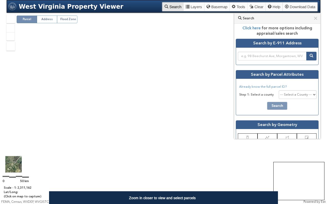 shows the map search surface and parcel context. County GIS downloads are also available through the State Data Clearinghouse under SB 588.
The state labels these tax maps as reference products, not legal boundary surveys. In a boundary dispute, the deed's metes-and-bounds description and a licensed survey control.
Mineral County Tax Dates Lead to the Sheriff
The Assessor values property; the Sheriff collects the tax. Mineral County tax bills come out in mid-July. Pay the first half by September 1 for the stated discount. The second half is due March 1. A bill goes delinquent April 1. Delinquent payments need guaranteed funds, such as cash, a cashier's check, or a money order.
Unpaid delinquent real estate goes to the yearly Sheriff's Tax Sale in November. The county's tax-office page links to the Software Systems search and payment path. A card payment through Point and Pay adds a 2.05 percent charge. The county page says the Clerk accepts redemption payments. These apply to real estate sold to individuals at the Sheriff's yearly sale. Sale lists, bidder terms, redemption periods, and fee details are not fully published online. Ask the Sheriff or Clerk for the current notice before acting.
See the Mineral County Tax Office for supporting context. 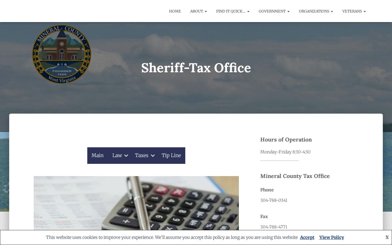 points to the official tax timeline. Treat the tax search as a separate record from the assessment value and recorded deed.
Keyser, Piedmont, and Ridgeley Add City Clues
Each of the three incorporated places has its own historical and municipal angle, but land records stay at the county level. Keyser is the county seat and uses ZIP 26726; Piedmont’s town listing uses 26750; Ridgeley was first called St. Clairsville and incorporated under its current name in 1914. A postal city can reach outside corporate limits, so confirm the boundary with the municipal clerk and parcel map.
City clerks may have permit, zoning, annexation, street-number, or code files. The research did not find a shared searchable permit database for the three towns. Keyser’s Tax & Building Permit Department has forms and an email submission path; Piedmont and Ridgeley permit history should be requested from their clerks by street address and parcel. Use the county Assessor and Clerk for the parcel and deed itself.
Address clues differ by town: New Creek, downtown and South Keyser; George’s Creek and the Piedmont core; or St. Clairsville and Ridgeley. The locality name can shift across a long ownership chain even when the land did not move.
Mineral County’s 1875 Land Sketch Aids Old Searches
Modern parcel layers cannot replace the older land books. WV Archives lists an 1875 Mineral County land sketch. It also holds the 1941 Inventory of the County Archives of West Virginia, No. 28. Those finding aids help frame a courthouse request. That matters when an old parcel description predates modern map numbers. The Clerk states no exact deed-book year runs or online-index cutoff. So request the grantor-grantee books and indexes by era.
The Archives Mineral County collection list also points to local histories and clippings. These cover old roads, houses, businesses, and the F&M Bank building. William Wolfe's history of Keyser spans 1737 to 1913. These works can surface a former street name or neighborhood clue. The deed still remains the evidence of a recorded transfer.
See the Mineral County archives finding aid for supporting context. 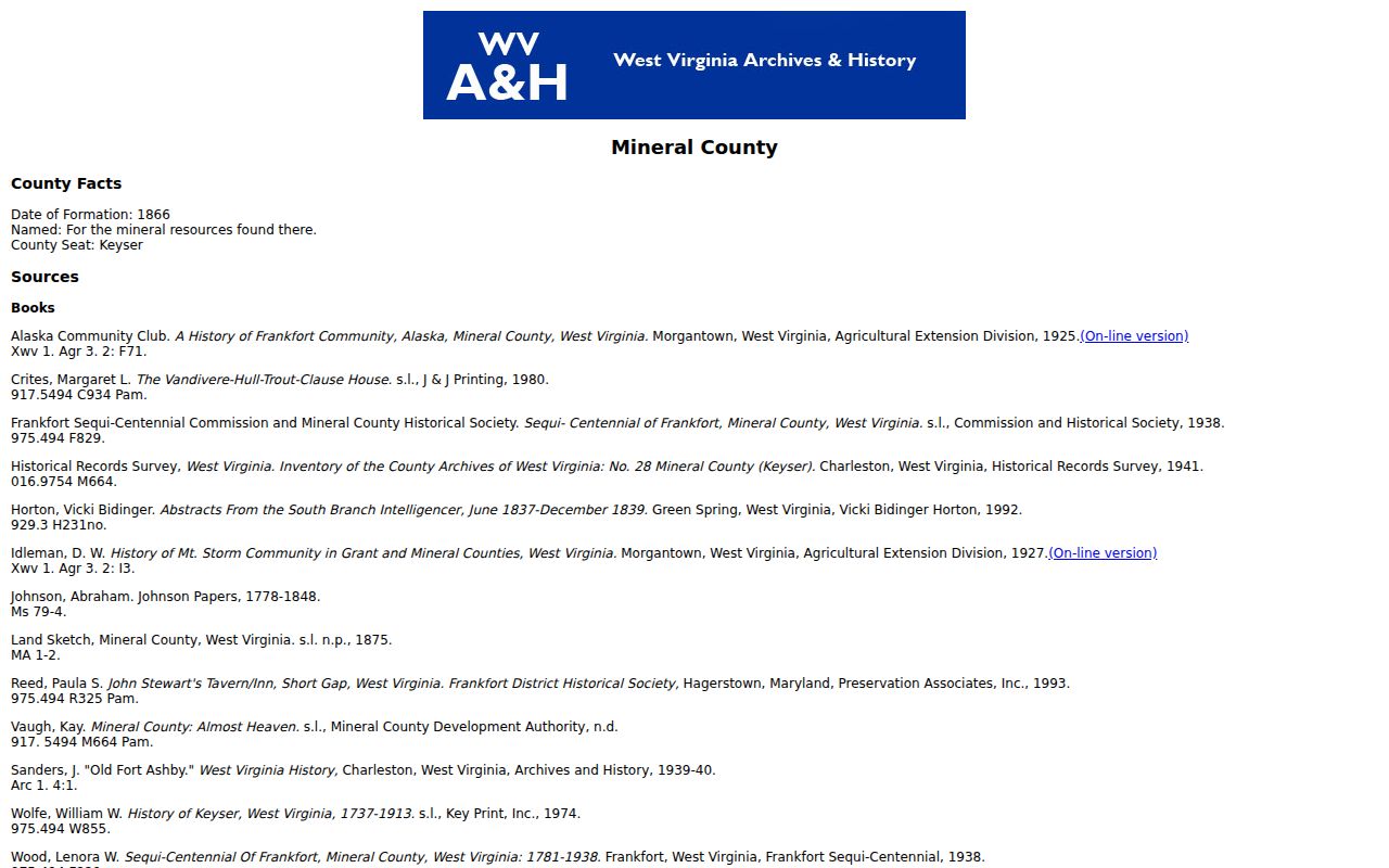 illustrates the county’s finding-aid path. The County Clerk should confirm which physical books cover a target date.
Mineral County Newspapers Bridge Old Addresses
Newspaper reels can tie together a house, a street, and a surname. A modern parcel search often lacks a historic address. WV Archives holds Mountain Echo and Our Mountain Messenger fragments back to July 1876. It also holds early Keyser Tribune fragments, later Mineral Daily News runs, and the long Piedmont Herald run from 1890 through 2006 with gaps. Pythian Banner issues run 1905 to 1912. A missing article may reflect a reel gap rather than a failed name search.
Potomac State College's local collections add the Evelyn Bane Mineral County Genealogy Collection, school yearbooks, and the WV Newspapers Portal. The J.C. Sanders Papers at the Keyser-Mineral County Public Library hold deeds, wills, genealogy, early history, and family histories. Treat these as leads. Then confirm any transfer in the deed index or probate record.
See the WV Archives newspaper coverage for supporting context. 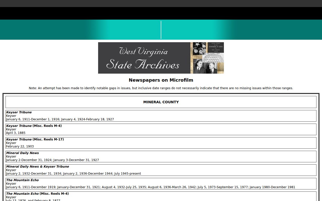 lists the microfilm coverage and gaps. The Potomac State community resources page introduces the college’s local-history collections. The
  collection offers a second route into names and local context.
Mineral County FOIA Is the Offline Fallback
Some Mineral County records never make it online. When that happens, write to the office that holds the record. West Virginia's Freedom of Information Act, starting at W. Va. Code §29B-1-1, lets anyone request records from the custodian in charge of them. Under §29B-1-3, the office must respond as soon as practicable, and no later than five days once weekends and legal holidays are excluded. Copy fees may match the actual cost of reproduction.
A strong request is a specific one. Name the parcel or street, the record type, any parties you know, and a date range. For a deed book, plat, probate file, or an older index, write to the Mineral County Clerk. The Assessor handles assessment cards and value corrections. The Sheriff can answer for a tax bill, a payment, or a current sale notice. The state SOS FOIA form covers records held at the state level, so it cannot replace a letter to a county office.
Check the county's official office directory before mailing anything. It confirms where each request belongs. Give enough detail to narrow the search, but remember that an unindexed paper file usually has no digital twin.
What Mineral County Property Records Can and Cannot Tell You
Mineral County property records answer many questions, but not all of them. A search can reveal the most recent owner of record. It also shows the annual assessment, tax status, recorded liens, and a mapped tax parcel. The limits matter just as much. The parcel viewer tracks surface land, not every mineral interest. A summary may list only one owner. Annual data can lag behind real events. A tax line on a GIS map is never a survey boundary. For a sale, bring in a title professional, a surveyor, or an appraiser working from the source deeds.
Lawful use. Use owner and parcel details for property research, due diligence, family history, or civic work. Do not use public information to stalk, threaten, or harass anyone, and verify a record with its custodian before relying on it.